Pasture-checking cattle during the breeding season isn’t much fun when we can’t find the bulls. So the applied livestock research team from Lakeland College in Vermilion, Alberta, with funding from Results Driven Agriculture Research (RDAR), investigated direct-to-satellite monitoring of cattle on pasture using GPS eartags to locate and monitor bull breeding. Alternative systems that require additional infrastructure, such as base stations or towers and receivers that must be kept within proximity of the animals, require power sources and more frequent moving, labour and time to set up or maintain.
Due to increasing land competition, western Canadian commercial cow-calf operations are forced to utilize marginal and/or heavily wooded, expansive grazing lands in remote areas. The sheer location, time and labour demands for managing these inaccessible pastures make remote sensing and automation appealing.
A beef-cow herd open rate typically averages less than 8%, but producers often see higher open rates when utilizing these heavily forested pastures. New technology, in the form of smart tags with accelerometers and GPS tracking – capable of capturing individual animal identity, movement and activity budgets – appeared promising for providing insight into bull libido.
The Lakeland College study took place in northern Alberta in a heavily forested pasture area. The area consists of aspen parkland and boreal mixed-wood vegetation zones of gently rolling topography in a continental climate. Cattle producers in this area generally conduct summer breeding seasons from June to July utilizing natural mating with bull-to-cow ratios of 1-to-25. The grazing season typically starts May 15 and, depending on precipitation and other environmental factors, can run until Oct. 15. Average temperatures and precipitation during this time can range from -3°C to 23°C (with extremes over 30°C) and 19 to 80 millimetres with extreme drought, respectively.
What was done
An observational field study to validate the real-time location and activity of bulls during a 65-day breeding season on harsh remote land was conducted. All 16 bulls and only 10% of the 350-head cow herd were GPS-tagged over two years. Weekly pasture observations occurred on horseback, and video capture was done by drone. DNA sire parentage matching confirmed offspring numbers per bull each year, ranging from six to 38 calves.

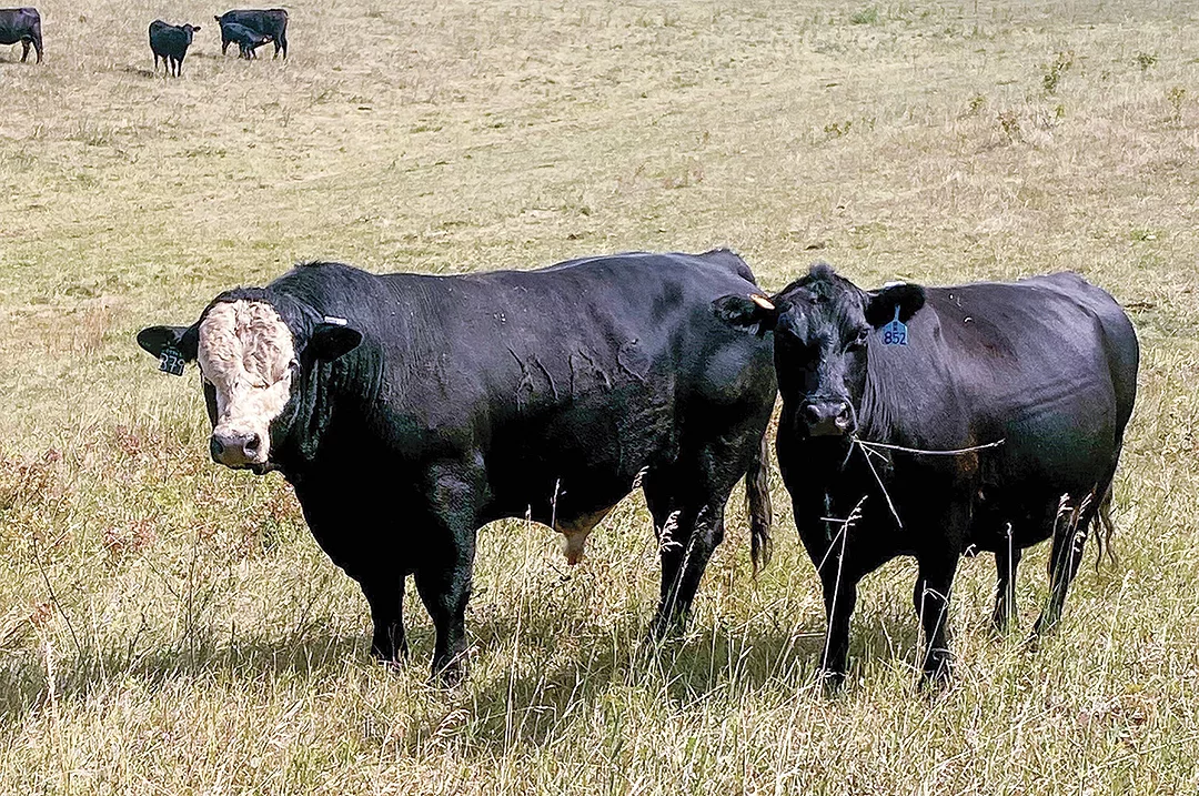
Depending on a ranch’s environment, monitoring bulls with GPS eartags can provide a strong return on investment. Courtesy image.
While we thought reductions in travel distance might be indicative of bulls siring fewer offspring, this wasn’t the case. Instead, those bulls whose GPS coordinates consistently matched more closely to the cow herd’s grazing movement sired significantly more calves. Some bulls would periodically rest or frequently return to common loafing areas while cow groups continued to rotationally graze the pastures. This observation reinforces the notion that bulls use their sense of sight first to identify cows in estrus, and if separated from cows, they may lack the motivation to search them out during the breeding season, especially after the first 21-day estrous cycle, resulting in fewer mating opportunities. It’s common sense that the bulls who stay with the cows have more chances to be sires, but it wasn’t obvious when we performed pasture checks who those bulls were without the GPS data to validate.
A return on investment calculator was created – with typical assumptions about time, labour, fuel and 30% tag replacement costs – to determine that pastures more than 50 kilometres from home can warrant using GPS tags as a decent investment in bull and cattle tracking. Injured and sick bulls could be identified and located to quickly get treated and/or replaced. Tag price points can limit use on all animals within a herd and in all seasons. This is particularly true for large herds and for extreme cold that reduces battery power (temperatures colder than -15°C). Depending on the data and results required of the technology, suggestions to have GPS tags on all the bulls but only on a portion (15% to 20%) of the cows may be warranted under extensive grazing scenarios in the north.
Current commercially available GPS collars and eartags can accurately detect locations to monitor livestock and ensure they remain within predetermined boundaries. Heavy tree canopy, cloud cover or precipitation events reduced the frequency of GPS location fixes and impacted the solar energy needed to recharge sensor batteries. Remote pastures typically do not have adequate cell service, internet or Wi-Fi coverage. Thus, viewing tag data may not function in the field, creating limits on how the data is used to manage cattle in real time. As an example, during the roundup, missing animals could not be viewed on smart devices in the pasture in real time. Instead, communication with a person with access to a computer to view cattle locations was required to inform them of their locations.

Courtesy image.
GPS eartags are available as nonreusable or reusable. Tags with antitheft features are typically nonreusable once attached to an animal. Reusable tags that can be removed from the animal after the breeding season were most practical for this particular study, especially due to the cold weather that followed the July-to-September breeding season.
Technology limitations
Technology limitations certainly exist for implementing this practice, including battery lifespan, transmission range, satellite orbit frequency, service coverage, storage capacity and economic affordability for the average ranch. Tags and collars can catch or snag on branches or fences and be damaged from animal-to-animal interactions. The ears of cattle can be ripped and injured, resulting in the loss of the wearable sensor or other eartags from that ear. Concerns exist over bull eartag retention of various designs, with one-pin-backed performing better than two-pin-backed GPS tags in our scenario. Bulls do a lot of fighting and rubbing on trees and fencelines, which can easily damage less robust tag designs. The tags are relatively pricey, typically valued between $125 and $300 per head, depending on the features you get.
Data platform subscriptions add additional cost to some wearable sensor arrangements. A company may provide only the sensor and not the data, so a third party must be involved to fully capture the data value. For example, data packages may include data points captured every hour, or only four to six times per 24-hour period, which may not be sufficient for specific behaviour assessments, especially mating events. Computer software specific to each sensor is needed to download the data. The frequency of data points is limited to the frequency of satellites orbiting in combination with environmental factors. Satellites from the Southern Hemisphere do not orbit as frequently in the Northern Hemisphere and vice versa. Thus, companies with wearable sensors in arrangements with a specific satellite provider may not provide as frequent data points if they are not aligned in the same hemisphere. Therefore, two animals standing beside each other may not have their data captured at the exact same time, meaning mating pairs could not be consistently identified through the GPS data.
Conclusions
GPS and accelerometers suitable for beef cattle tracking exist in several commercially available solutions on the market. Remote livestock monitoring for well-being using real-time or near real-time tracking on rangelands appears feasible and economical under certain scenarios due to recent technological advancements. However, technology limitations must be recognized to properly understand the true value of the data.