
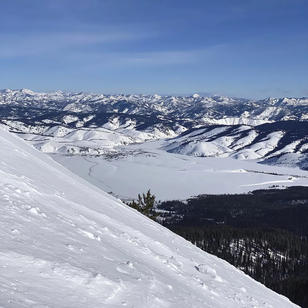
A couple of weeks ago, I needed to teach an irrigation management class in Malad. As I drove down I-15 over the Malad Pass, it was about noon on a sunny day. The view from there was just beautiful. The snow was deep, and the trees were all flocked with snow. For an old water junkie, it was just what the doctor ordered. I totally loved it. To me, it looked like water. When I arrived in Malad, I had to get my phone out and check the Snowpack Telemetry (SNOTEL) site again. It confirmed what I was looking at, a good snowpack for late January.

I will admit, I am addicted to looking at the SNOTEL sites in the western U.S. Very rarely do I miss a day without checking the SNOTEL reports – what a great innovation and use of technology. It has real-time data that has proven to be accurate. The information comes from remote backcountry collection sites that measure several weather conditions and transmit the data wirelessly. We now have over 800 sites located throughout the western U.S. It was originally funded and maintained for water managers that needed to know how much water would be available to fill reservoirs and to give water managers information for drought and flood control.
I’ll give you an example of how it can be useful. I was an irrigation district manager in 1997. Each year around May 20, the Bureau of Reclamation has what they call the Idaho NRCS Snow Survey Program. They start at Burley and drive along the Snake River up to Idaho Falls, viewing different items of interest along the way. At Idaho Falls, they follow the South Fork of the Snake River to Palisades Reservoir. They then proceed to Alpine and Jackson Hole. That evening, they hold a meeting for all entities that have an interest in water on the Snake River. It usually consists of fishing groups, whitewater rafters, boaters from Jackson Lake and Palisade Reservoir, irrigators and campers, to name a few. In short, it is a large, vocal group of people who are interested in the operation of the Snake River for the upcoming summer season.
The next day, the tour continues up to Jackson Lake, through the south entrance of Yellowstone National Park, up to Old Faithful, over to West Yellowstone and down the Henry’s Fork of the Snake River, stopping every so often to take pictures to compare with years past.
Each year, they invite different water interests to accompany them. It is a great opportunity to get a real feel for what the water year is going to look like. This particular year in 1997, as we left Burley and proceeded to Palisade Reservoir, we noticed that the South Fork was extremely high, right at flood stage, which is at around 18,000 cubic feet per second (cfs) to 20,000 cfs. We pulled up to the top of the reservoir, and it was totally empty – the lowest I had ever seen it. We looked around the nearby mountains, but there was no snow to be seen.
As a group of irrigation managers, we looked at each other and tried to decide if we needed to buy one-way plane tickets to South America. We voiced our opinions to the Bureau of Reclamation’s river operations manager, who was standing there. He ignored our opinions and just kept saying we needed more reservoir space. We thought he had lost his mind. We proceeded on to Jackson Hole, held the meeting and he continued to say we would be in total flood control this summer. After we left Jackson Hole the next morning, we still feared the worst. But, when we hit Jackson Lake, we started to see what he was talking about. The ride through Yellowstone was like a bobsled run. The SNOTEL reports were correct. We would have plenty of water that summer. A month later on June 20, we had 47,000 cfs thundering out of American Falls Reservoir.
That is measuring water on a large scale. However, it is also important to measure the small stuff. I always like to measure the springs or streams on the family ranch or farm. It gives you a record to see exactly what they are doing. Is your spring drying up? Did that same stream dry up during the 1930s – just how dry is it getting? Maybe something else is going on. I might also note a lower aquifer level from groundwater pumping, more junipers on the watershed or if the noxious weeds are becoming more of a problem. Maybe it is that dry.
It is extremely hard to look at a stream or spring and say what it is actually doing without accurate measurements and records. If you need help, contact us. We can help you get measuring devices installed or help you get somebody that can. There are all kinds of devices, and some are really inexpensive. We continue to get more water meters installed on deep wells each year. Let’s start using that data to help us make informed decisions about our water. How many kilowatt-hours per acre-foot pumped does your well use? Is your well efficient, or is there something going on with it? Along with getting the quantity of water pumped, I would also get the water depth of your wells. It isn’t hard to do and could be important down the road.
We need to learn more about our water and not take it for granted. As the old saying goes, "Water is the lifeblood of Idaho."


.webp?height=auto&t=1783636475&width=285 "63802-Thomas-GPS-equipment--Automated-Magnum-Tractor--Matt-Skinner-photo(1).jpg")

