

A recent update to the FAA’s Part 107 regulations for flying drones is just one factor contributing to the increase of drone use in forage fields. These changes create greater access to drones, allowing anyone interested in the technology the opportunity to operate them.

But that’s only half of the story. As anyone in business knows, in order for a tool to make sense on the work site, it first has to make sense on the bottom line.
In order to see a return from a drone investment, forage professionals need to know how to use a drone to save time, improve efficiency and increase yields. Then, the real key to unlocking the true value of a drone comes from understanding the technology behind it.
Aerial imagery
The high-quality images produced by drones are used for everything from preseason scouting to monitoring crop health to identifying equipment issues. Drones produce three common image types:
-
Color (RGB) – RGB images are similar to photos from a regular camera. They’re easy to look at and understand even for the novice drone user, but are the least descriptive of the three types.
-
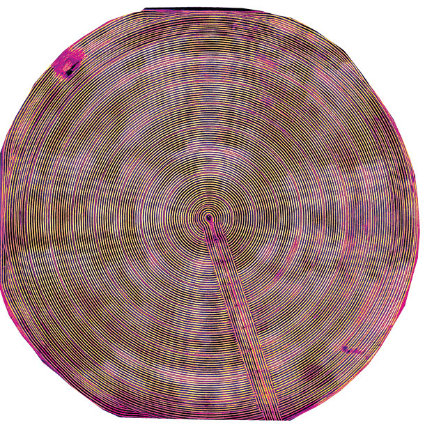
Near infrared (NIR) – NIR provides images with higher levels of detail than those produced by RGB by utilizing color bands outside the light spectrum visible to the human eye.
- Normalized difference vegetative index (NDVI) – NDVI uses both visible and NIR sunlight reflection to measure biomass (vegetation). Similar to NIR imagery, NDVI provides a higher level of detail than RGB images.
Each of these image types plays an important role in the various applications for which drones are used.
Preplanning
The coverage area, vantage point and speed a drone provides makes it a great tool for preseason scouting. Using standard RGB imagery, the drone can produce 3-D maps used for soil evaluations, topography reviews and identification of drainage issues.
By gathering, reviewing and evaluating this mapping data prior to planting, forage growers not only have a complete view of the area, but they’re able to identify problems and adjust planting strategy before, rather than during, the season. Because the imagery produced is similar to that of a camera, RGB is a great choice for preplanning applications and enables growers to easily “see” the big picture.
In-season assessment
The primary advantage of drones over a manual scouting process is speed. An area normally monitored by a crop scout in several hours can be covered in a single, quick drone flight. This allows for one of the most common uses of drones in agriculture – ongoing monitoring of crop health throughout the season. NIR imagery is most valuable in this process for several reasons.
First, NIR images show heat, so they can easily identify areas of plant and water stress. Their high level of detail gives them additional applications such as weed detection, defining management zones, evaluating effectiveness of ponding and water management, and quantifying machinery-induced crop limiting factors. This ability to identify concerns and intervene quickly is directly linked to a better year-end harvest.
While NIR images are generally best for assessing crop vigor across a field throughout the season, there are uses for RGB images in-season as well. They’re often used to identify planter skips and evaluate areas of lost production, allowing growers to correct the problems.
Long-term analysis
In addition to their immediate help before and during the season, drone use can be beneficial over long periods of time. Like RGB and NIR, NDVI images can also show ponding, help growers assess crop vigor and show changes in field conditions over time.
NDVI images measure the amount of biomass or “greenness” of a plant and create an index, which is then compared to areas of less vegetation and more vegetation. The numbers range from -1 to +1, with high amounts of biomass and green vegetation having increasingly positive numbers.
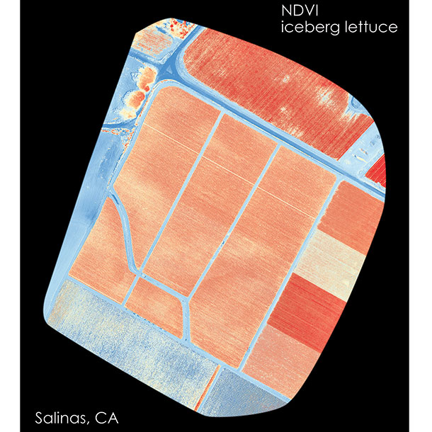
NDVI values are very sensitive to anything that affects light, such as haze, clouds or even soil. For this reason, NDVI images are most effective in optimum conditions.
Humanizing drones and data
Even with all the advantages of drone use, there is still no replacement for crop scouts and other field personnel. Ground-truthing requires both analysis of the acquired imagery and on-foot verification of the area of concern. Using these methods together allows growers to understand the cause of any problem, assess magnitude and make decisions to correct it.
Bottom line: A drone is a helpful tool that can provide all the data and images you need, but it’s still up to the grower to analyze data and use it to make the best decisions for the crop. ![]()
Matt Hayes is a mapping product supervisor, and Bill Edmonson is a UAS product specialist, both for RDO Integrated Controls and based in Billings, Montana. Visit RDO Integrated Controls to learn more about UAS for agricultural use.
Nate Dorsey is an agronomist with RDO Equipment Company. He can be reached at this website.
PHOTO 1: This is an RGB image of the Purdy Ranch in Silver Creek, Idaho.
PHOTO 2: This is an NIR image of an irrigation pivot.
PHOTO 3: This is an NDVI image of iceburg lettuce, which shows high contrasts. Images provided by RDO Equipment Company.


